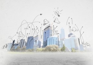
3D city planning

Now with the latest geospatial technology and the increased processing power of computer hardware, 3D modelling is feasible and requires much less time and effort. Directions Magazine has an article that explores a 3D modelling approach: Three-dimensional City Planning Using Photogrammetry and GIS. The article describes how photogrammetric data and GIS software tools are used to produce 3D city models.
These models enable the study of complex urban environment and find solutions for various threats and challenges involved with urbanisation. Especially in Asia, where issues such has: exponential population growth and in-migration of poor people, industrial growth, inefficient and inadequate traffic corridors, lack of services and amenities and solid waste generation, are having adverse impacts on human life in city environments. 3D modelling and visualisation systems support the decision making process allowing quick evaluation and communication of ideas, leading to better urban planning and administration outcomes.
Closer to home, Brisbane City Council has developed a spatially accurate and interactive 3D model of Brisbane City’s CBD and inner 5 kilometres. The 3D model is known as Virtual Brisbane. It is an important strategic planning, development assessment and community engagement tool that is use by the Council.
The challenge in generating these 3D models are:
- Sourcing the data required for the model.
- Having sourced the data, maintaining the data and keeping it up-to-date.
The 3D modelling approach described in Directions Magazine requires CAD layers for features such as roads, railways, pipelines, poles and buildings. These CAD layers may be relatively easy to acquire in Asia with centralised governments and government departments responsible for such infrastructure. It can present a quite challenge here in Australia to acquire this information. There can be up to 3 levels of government that are responsible for this infrastructure being: State Government, Local Government Authorities and Government Owned Corporations (i.e. Water Utilities, Energy Utilities). Each one has to be approached and negotiated with to obtain the CAD layers.
Consideration needs to be given when you are developing your models on how you will maintain them into the future. When negotiating with stakeholders to acquire the data for your model, you should make sure a process can be established that will allow access to ongoing updates of that data. I have witnessed people neglecting to do this and having to start again from the beginning when they come to update a model. This includes re-negotiating with stakeholders to access the updated data.
Leave a Reply